


An Appraiser’s Eye in the Sky
Canadian Property Valuation Magazine
Search the Library Online
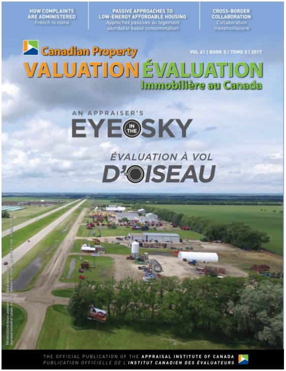
An appraiser’s eye in the sky
Unmanned Aerial Vehicles (UAVs), more commonly known as ‘drones,’ have increased rapidly in popularity over the last few years. As UAV technology has improved, learning to fly them has become easier, the quality of photos or videos that can be taken has improved, and the price of purchasing a good quality unit has decreased. As a result, UAVs have become a tool that many in the real estate industry are beginning to utilize, both for still images and for marketing videos.
Transport Canada guidelines: recreational vs commercial
For those considering using a UAV for appraisal assignments, you must be aware of Transport Canada’s various regulations and classifications. I would encourage appraisers to do their own research on this subject, as this article only reflects my personal experience.
Basically, if you are flying a UAV for any purpose other than the sheer ‘joy of flying,’ you are considered a commercial user, not a recreational user. Commercial use includes situations such as taking aerial pictures of a friend’s home for the purposes of listing the property for sale, or any other similar use, even if money does not change hands.
Based on that definition, for the purposes of real estate appraisal, commercial guidelines need to be followed. In order to comply with these guidelines, the key requirements are to obtain a Special Flight Operations Certificate (SFOC) from Transport Canada and to purchase liability insurance with a minimum of $100,000 in coverage. Liability insurance coverage can be obtained through most providers, however, I have found that most will not sell a policy written for less than $500,000. My annual cost of insurance for this level of coverage is approximately $750-850.
The process of obtaining an SFOC involves filling out a detailed application form and preparing an operations manual. While there is currently no cost to complete the application, it is not a simple form and requires a significant amount of time. I recommend using a third party who specializes in assisting users in completing these applications. While this does involve a cost, it saves time and increases the probability of your application being approved quickly. In my case, while there are other organizations that provide a similar service, I hired FliteLab (www.flitelab.com) to complete the application after following them online and reading their blog posts, which discuss current issues with utilizing UAVs in Canada as well as changes in the law and guidelines. The cost of the service was $850 plus HST.
There are multiple types of SFOCs available with various restrictions, however, when you are starting out, and without extensive experience with a UAV or formal pilot training, it is likely best to apply for a restricted operator – complex version, as that is most likely to be approved.
Once you are approved, each flight involves contacting NAV Canada (which is a privately run, not-for-profit corporation that owns and operates Canada’s civil air navigation system) 2-3 days before each proposed UAV flight, in order to provide them with the date, time, coordinates, and length of flight, along with the maximum radius from centre of that location and the maximum altitude of the flight above ground.
In cases where the proposed flight is in proximity to an airport or aerodrome, a notice to airmen (NOTAM) must be filed 24 hours prior to the flight by contacting the local NAV Canada Flight Information Centre and detailing the above information once again. Depending upon the traffic volumes of the airport and the location of the flight, coordination with the airport control tower prior to and following the flight may also be required. To determine whether or not your flight is within the radius of an airport, the National Research Council of Canada has a ‘UAV Site Selection Tool’ website which allows you to research this in advance.
Five reasons why appraisers should consider UAVs
Given the time and expense in obtaining permission to legally operate a UAV for commercial purposes, why would appraisers want to include this as part of their service? For basic residential mortgage financing assignments, it is likely not worth the time and expense incurred. However, for commercial, agricultural or speciality residential properties, I believe it is worth looking into. Here are five reasons why you should consider using a UAV:
- Gain a current perspective – While information from online satellite imagery providers such as Google Maps and Microsoft Bing has been a huge benefit to appraisers to see an overview of a neighbourhood, and while some municipal jurisdictions provide aerial photos online, the information from this third-party imagery is not always up to date. A UAV can give you the most current imagery of a site’s layout including any new developments in surrounding areas. As well, since UAV images are taken at a lower altitude than satellites or airplanes, the resulting images are generally higher resolution and more detailed.
- Roof inspections – Access to view the condition of a roof is rarely a simple endeavour. At best, it involves obtaining access to a locked ladder attached to a building, or, at worst, using ladders to access an attic hatch through what is often a very small opening. As a result, we often have to invoke extraordinary assumptions and take the client’s word on the roof condition and when it was last serviced or replaced. With gable roofs, you can often gain some perspective on the condition, however, for low pitch metal or tar and gravel roofs, as well as on taller buildings, this is not as easy. While a UAV does not replace a formal roof inspection, and most appraisers are not qualified to fully evaluate the condition of a roof, using a UAV to at least provide a cursory observation can provide information as to whether or not there is evidence of ponding or foliage growing on the roof, or if the gravel is removed and exposing the cover to UV light, which may indicate that servicing is required.
- View difficult to access locations – This is most frequently encountered in agricultural appraisals, as not all parcels of farmland are easily accessed by public all-weather roads or by foot (especially if it has rained the night before). Sometimes, there is a mix of bush and cultivated land, which makes it difficult to get a good overall view of the parcel from the most accessible location. If you know where the parcel you want to inspect is located, you can often get a better perspective using a UAV (as long as you can maintain a line of sight to the UAV, which is typically a condition of most SFOCs).
- Enhance credibility – When I ask a client if he or she minds me using my UAV to take aerial photographs of the property, most are very interested and eager to see the results. UAVs are still somewhat of a mystery to the general public and using them can increase your credibility by demonstrating your investment of time and energy in order to evaluate the property from every angle. As appraisers, while the values we arrive at may not always make our clients happy, establishing credibility and a higher level of due diligence throughout the appraisal process will only help to reduce complaints.
- Differentiation and diversification – By utilizing this technology in the valuation process, you can set yourself apart from other appraisers in your area. Reports that include aerial images can provide clients with additional value and provide appraisers with the opportunity to provide ‘a la carte’ services such as offering copies of the photos to use in marketing materials or in the sale of the property.
My experience
I purchased a DJI Phantom 3 Professional in 2016 (current retail price is approximately $1,100, plus taxes) and have been using it for about a year. For the first few months, I used it commercially only in areas that fell under the prior rules which permitted me to operate commercially under exemption guidelines. This meant only in rural locations, well away from airports. Transport Canada amended the commercial exemption rules in late 2016 and, at that point, I obtained an SFOC, which I have been operating under since then. Due to the cold Manitoba winters, I am not able to use my UAV all year, as UAVs do not function well in temperatures below about -10 Celsius. As well, if winds are greater than 25-30 km/hour, operating a UAV is not recommended. I have also encountered problems when flying near hydroelectric substations due to the electromagnetic fields (which can disorient the on-board compass).
Typically, my flights last less than 10 minutes, but that depends on the location and complexity of the site. The battery is rated to last about 23 minutes (less in cold weather) and I carry a backup as well. For a single parcel commercial or agricultural property that is not too large, taking aerial photographs adds about 20 minutes to my inspection time, a few minutes in advance to notify NAV Canada about the flight, and a few minutes to download the images to my computer.
Privacy Considerations
It is important to seek permission from the property owner prior to the flight, and not to fly near overhead power lines, or over buildings or people.
The Office of the Privacy Commissioner has ruled that taking photographs of a property might constitute personal information, as it could show information of a personal nature which could be linked back to a specific individual.
You should take precautions to make sure that any photographs they take meet the requirements of personal information under PIPEDA. This includes making sure you obtain the knowledge and consent (preferably written) of individuals who may appear in photographs of the property. Reasonable effort must be made to ensure that individuals understand how the information will be used or disclosed.
It is recommended that at no time should photographs of individuals, particularly minors, be taken or included in appraisal reports.
You should also be aware that Transport Canada operational restrictions exist concerning UAV flights, photography and video recording. These restrictions include:
- minimum and maximum altitudes,
- clearance from objects, and
- flight over public or private property while recording (Transport Canada requires evidence that landowners have been made aware of the proposed operation and have no objection to any UAV flight under 2000 feet over private property
These restrictions are issued on a case-by-case basis and are detailed in the SFOC.
In addition to the Transport Canada rules, there may be other laws including the Criminal Code, provincial legislation, trespass and privacy laws to consider.
For concerns regarding UAV pictures or videos of people, animals and private property, contact the Office of the Privacy Commissioner of Canada.
Conclusion
To close, I want to stress that, if you decide to add a UAV to your set of tools, it is crucial that you research all Transport Canada guidelines to ensure you are in compliance. This article is not meant to be formal legal advice on this topic, but rather to reflect my personal experience. UAVs are relatively new and the rules are still evolving for both their recreational and commercial use, so it is vital that you stay current.